On 29 April 2020, a single bolt of lightning ignited above eastern Texas, leapt across the Louisiana border, and stopped only after it had crossed Mississippi — 768 kilometres of continuous electrical discharge, certified by the World Meteorological Organization as the longest single flash recorded at that time. End to end, it covered roughly the straight-line distance between New York City and Columbus, Ohio.
The bolt did not strike the ground along most of its path. It travelled horizontally, threaded through the underside of a sprawling overnight thunderstorm complex, branching as it went, illuminating a strip of sky longer than the United Kingdom.
What a megaflash actually is
Most lightning is short. The average cloud-to-ground bolt covers less than 16 kilometres. A flash that crosses 100 kilometres of sky earns a separate name: megaflash. According to research studying record-setting flashes, fewer than 1 percent of thunderstorms produce them at all, and only a fraction of those exceed 500 kilometres.
The April 2020 flash was unusual even among megaflashes. It was photographed from orbit by the Geostationary Lightning Mapper, an instrument bolted to the GOES-16 satellite that scans the western hemisphere for optical lightning emissions hundreds of times a second. Without that satellite, no ground-based network could have captured the full extent of it. The flash was simply too long for any single sensor on Earth to see.
Texas, Louisiana, Mississippi — in one breath
The storm system that produced the bolt was a mesoscale convective complex, the kind of overnight thunderstorm cluster that drifts across the Gulf states each spring. These systems can stretch across vast regions and persist for many hours. Inside them, sheets of charge accumulate along the stratiform region — the broad, low-rainfall back end of the storm, where ice crystals settle into thin horizontal layers.
That layered geometry is what makes megaflashes possible. A bolt that begins as a vertical strike near the storm’s leading edge can find a low-resistance pathway running rearward through the stratiform deck, and follow it for hundreds of kilometres before the charge difference dissipates. The 2020 flash did exactly that, beginning over Texas and propagating east-northeast across two state lines before terminating in Mississippi.
A car driving a comparable distance would need most of a day. The flash crossed that scale of sky as a single electrical event, visible in full only because satellites were watching from above.
What scientists finally figured out about the trigger
For decades, the question of what physically initiates a lightning bolt inside a thundercloud was open. The electric fields measured inside storms are often too weak to ionise air directly. Something else has to start the cascade.
In 2025, a team led by Victor Pasko at the Penn State School of Electrical Engineering and Computer Science published the first quantitative model of lightning initiation. The trigger, they showed, is a chain reaction seeded by cosmic rays.
A high-energy particle from deep space enters the atmosphere, collides with an air molecule, and produces a shower of relativistic electrons. Inside the strong electric field of a thundercloud, those electrons accelerate further, crashing into nitrogen and oxygen molecules. The collisions emit X-rays. Those X-rays free more electrons through the photoelectric effect. The new electrons accelerate, emit more X-rays, free more electrons. The avalanche compounds in a fraction of a millisecond.
According to the research, the findings provide the first precise, quantitative explanation for how lightning initiates in nature, connecting X-rays, electric fields, and electron avalanche physics.
The X-ray burst that accompanies this process is called a terrestrial gamma-ray flash. These bursts are invisible to the naked eye, but they can carry energies far beyond visible light. Pilots flying through thunderstorms can pass through the broader storm environment without seeing the high-energy cascade that helped start the discharge.

Why the April 2020 flash was a record, not an outlier
The 768-kilometre figure was not announced until February 2022, when the World Meteorological Organization’s committee on weather and climate extremes finished verifying the satellite data. The previous record — a 709-kilometre flash across southern Brazil in October 2018 — was beaten by about 60 kilometres.
Both records depended on the same new generation of satellite observation. Before geostationary lightning mappers came online, lightning detection relied heavily on ground networks that triangulated radio emissions from individual strokes. Those networks were never designed to stitch together a single flash spanning three states. The megaflash record has been broken several times since satellites started watching, not because storms are necessarily getting bigger, but because humans finally have the right eyes for them.
In 2025, that record fell again. An 829-kilometre flash — about 515 miles — was confirmed across the Great Plains from eastern Texas to near Kansas City. Researchers refer to these record-breaking events as megaflash lightning. The 2020 Texas-to-Mississippi bolt is no longer the longest. It is still one of the longest single flashes ever measured.
The danger of a clear sky
A megaflash can deliver a ground strike far from the part of the storm most people are watching. These flashes can travel through electrified cloud regions on a scale that makes ordinary storm-distance instincts feel misleading.
The standard safety guidance — if you can hear thunder, you can be struck — remains useful, but megaflashes show why distance can be deceptive. The World Meteorological Organization has warned that electrified clouds can produce flashes that travel extremely large distances, creating what lightning specialists have called a “bolt from the gray,” a cousin of the better-known “bolt from the blue.”
The 2020 megaflash, fortunately, did not become known for casualties. The danger is statistical: if megaflashes are identified more often — and there is no evidence yet that they are becoming more common, only that we are now able to count them — more people may realize they were standing under skies that looked safer than they really were.
What lightning sounds like from 100 kilometres away
It sounds like nothing. Thunder travels at roughly 343 metres per second through warm air, and is absorbed and refracted by atmospheric layers as it moves. A bolt tens of kilometres away may produce no audible sound at the surface. A bolt hundreds of kilometres away might as well be on the moon.
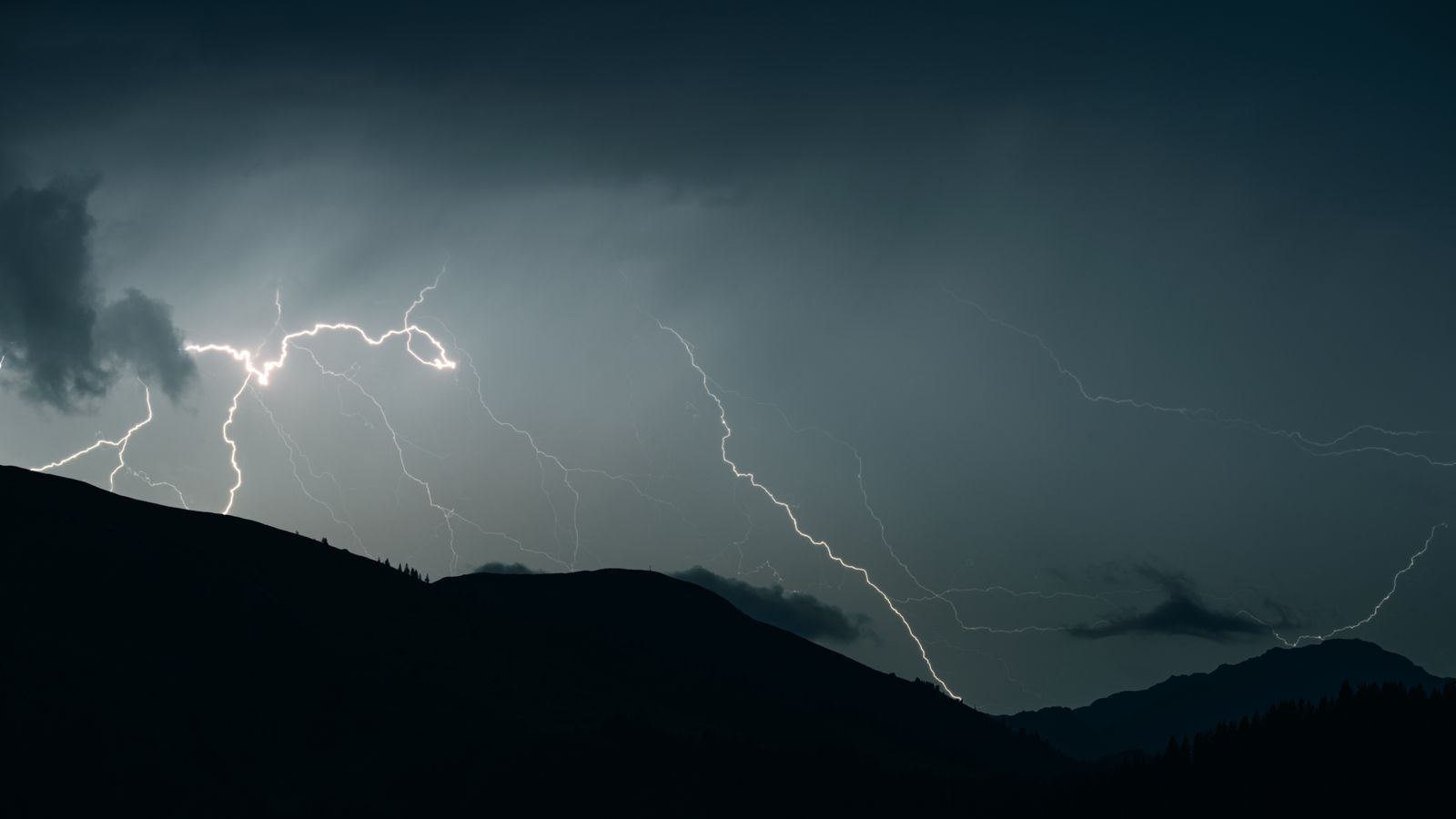
What it looks like, if you happen to be standing under the storm’s stratiform deck, is a slow horizontal flicker that crosses the visible sky, persists for several seconds, and disappears. It does not crack. It does not boom. The branches drift sideways across the cloud base the way a river finds its way across a floodplain — except that the river is electricity, and the floodplain is the underside of a thunderstorm the size of a small country.
Most observers on the ground that April day in 2020 simply saw flashes in the distance. The fact that they were watching a single continuous discharge — one electrical event, sustained across 768 kilometres of sky, from Texas to Mississippi — was only knowable from orbit, by instruments scanning the hemisphere for exactly this.
The cosmic ray that helped trigger the cascade may have been travelling for somewhere between thousands and billions of years. The bolt it seeded lasted only moments. The thunder, where there was any, was gone before the cloud had finished drifting east.