More than one billion users turn to the navigation app Google Maps, for essential information about how to get from place to place – especially during this pandemic when safety concerns are on top of the list.
In order to help mitigate the spread of the pandemic, Google has another tech tool via Google Maps. The tech giant has introduced a “COVID layer” in Maps, a tool that shows critical information about COVID-19 cases in an area. It is designed to make people feel more confident while traveling during this pandemic.
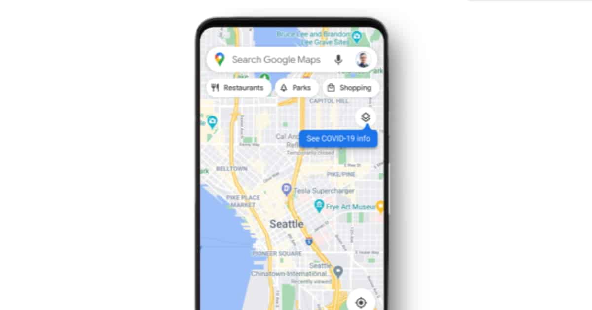
How it works
When you open Google Maps, tap on the layers button on the top right-hand corner of your screen. Under the drop-down menu, click on “COVID-19 info”.
You’ll then see a seven-day average of new COVID cases per 100,000 people for the area of the map you’re looking at, and a label that indicates whether the cases are trending up or down.
Color coding also helps you easily distinguish the density of new cases in an area. Trending case data is visible at the country level for all 220 countries and territories that Google Maps supports, along with state or province, county, and city-level data where available.
Reportedly, below are the six different colors displayed, each noting a different data set:
- Grey: Less than 1 case
- Yellow: 1-10 cases
- Orange: 10-20 cases
- Dark orange: 20-30 cases
- Red: 30-40 cases
- Dark red: 40+ cases
Data source?
Data featured in the COVID layer is aggregated from multiple authoritative sources, including Johns Hopkins, the New York Times, and Wikipedia.
These sources get data from public health organisations like the World Health Organisation, government health ministries, along with state and local health agencies and hospitals.
Google uses the same sources for the information displayed on its search engine, and Google is now expanding this data to Google Maps. The COVID layer starts rolling out worldwide on Android and iOS this week.
In order to help people stay safe when they are out and about, Google Maps has already introduced a number of coronavirus-related features, including information about testing centers, driving alerts about Covid-19 travel restrictions, and alerts about any potential impacts on public transit, including mask-wearing mandates.
Features like popular times and live busyness, COVID-19 alerts in transit, and COVID checkpoints in driving navigation have also been introduced by Google Maps.
Image credit: Google